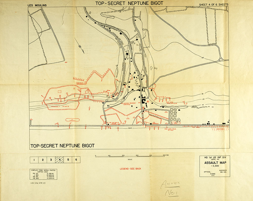
Top-Secret Assault Map of Les Moulins, France
June 1944 Intelligence Report
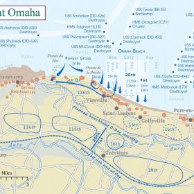
This reconnaissance map was created by the 1st Infantry Division’s intelligence section for use by the landing force. It illustrates possible mined areas, machine-gun positions, and obstacles for this section of coastline. Maps like these would have been indispensable to the soldiers who landed at their assigned landing site. This map corresponds to Dog Red and Easy Green, sections of Omaha Beach that were assaulted by members of the 116th Regiment, 29th Division.