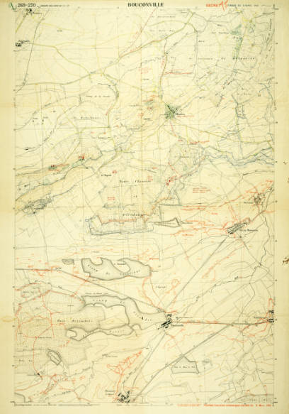
Bouconville: 1:10000.
- Creator: Groupe de Canevas de Tir.
Relief shown by contours, spot heights and landforms.
- OCLC #: 927172020
- Call #: G5831 1918.S65
- Physical Location: Special Collections — Hunter — MAP 00785
- Personal Collection:
- WWI Hunter Collection
- Production, Publication, Distribution, Manufacture, and Copyright Notice: [France] : [publisher not identified], 1918.
- Edition:
- 6th edition.
- Physical Description: 1 map : color ; 100 x 66 cm
- General Notes:
- Relief shown by contours, spot heights and landforms.
- French trench positions circa March 1918 shown with red form lines.
- Features natural land formations such as forests, lakes, and rivers and man-made structures including roads, railroads, and towns. Many of the natural and man-made features are named.
- Includes diagram of magnetic declination.
- Sheet 269-270.
- "Groupe des canevas de tir."
- "Secret."
- Electronic Access:
